Category:Gila Bend, Arizona
Jump to navigation
Jump to search
town in Maricopa County, Arizona, United States    | |||||
| Upload media | |||||
| Instance of | |||||
|---|---|---|---|---|---|
| Location |
| ||||
| Inception |
| ||||
| Population |
| ||||
| Area |
| ||||
| Elevation above sea level |
| ||||
| official website | |||||
 | |||||
Subcategories
This category has the following 7 subcategories, out of 7 total.
A
E
- Exercise Crimson Eagle (12 F)
G
- Gila Bend Municipal Airport (4 F)
- Gila Bend Overpass (5 F)
H
S
- Solana Generating Station (5 F)
Media in category "Gila Bend, Arizona"
The following 26 files are in this category, out of 26 total.
-
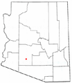 AZMap-doton-Gila Bend.png 260 × 300; 22 KB
-
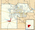 Maricopa County Incorporated and Planning areas Gila Bend highlighted.svg 940 × 812; 1.05 MB
-

-
 3-line distance sign, I-8, Gila Bend, AZ.jpg 2,848 × 1,854; 1.48 MB
-
 Angel Thunder 111015-F-CF799-008.jpg 4,256 × 2,832; 6.8 MB
-
 Arizona deluxe accomodations (5402348604).jpg 3,852 × 2,539; 3.29 MB
-

-
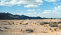
 Desert Gila - panoramio.jpg 766 × 577; 77 KB
-
 Desert Southwest 69.jpg 3,024 × 4,032; 2.64 MB
-
 Flag of Gila Bend, Arizona.gif 360 × 216; 23 KB
-
 Gatlin Site.jpg 247 × 145; 25 KB
-
 Gila bend - panoramio (1).jpg 779 × 562; 87 KB
-
 Gila bend - panoramio (2).jpg 800 × 619; 57 KB
-
 Gila bend - panoramio.jpg 786 × 538; 79 KB
-
 Gila Bend Air Force Auxiliary Field - AZ - 8 Jun 1996.jpg 606 × 867; 164 KB
-
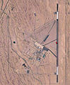 Gila Bend Air Force Auxiliary Field AZ 2006 USGS.jpg 726 × 876; 198 KB
-
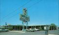 Gila Bend Travelodge 1971.png 802 × 489; 636 KB
-
 Gila Bend-Town of Gila Bend.jpg 2,176 × 2,048; 1.12 MB
-
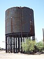 Gila Bend-Water Stop-1920.jpg 2,448 × 3,264; 1.92 MB
-
 Gilabendsign.jpg 488 × 309; 108 KB
-
 Gilantium coating - panoramio.jpg 4,000 × 3,000; 4.59 MB
-
 HH-60 Pave Hawk.jpg 950 × 631; 83 KB
-
 Indiana National Guard (31845194971).jpg 4,288 × 2,848; 2.21 MB
-

-

-
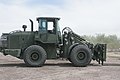 US Marines loader.JPG 3,600 × 2,400; 3.77 MB


.jpg)


.jpg)
.jpg)


.jpg)


